|
Home > Habitat > the National park of Conkouati-Douli
•The National park of Conkouati-Douli
ø General Situation
- the National park of Conkouati-Douli, of a
surface of 504 950 hectares, is in the area of Kouilou. This area extends
along the Atlantic Ocean from Cabinda to Gabon. It is in this septentrional part
that the park is. It takes place both on the sub-prefectures of Madingo-Kayes and
Nzambi.
- It is limited:
· in north by the Gabonese border,
of the village of Cotovindou, with the road Ndindi (Gabon)/Nzambi;
·
in the west by the Ndindi/Nzambi
road, then by the border to the Atlantic coast, with the mouth of the lagoon of
Mekoudji up to twelve marine miles of the coasts;
· in the
south since the Victoria beach, by the Noumbi river, then by its affluent to the
village of Loulema. Then by the Youngou/Tchizalamou road until Tchizalamou; in the
south since the Victoria beach, by the Noumbi river, then by its affluent to the
village of Loulema. Then by the Youngou/Tchizalamou road until Tchizalamou;
· finally in the east, by the Tchizalamou/Youbi road until
Nkola, then by the Youbi/Poumpou road to the bridge on Noumbi, then by Noumbi to
the bridge of the Bioko/Cotovindou road, then by this road until Cotovindou.
- Its relief, of south-west in the North-East is composed:
· of a sedimentary basin with a littoral plain along the ocean;
· notched plateau of marshy valleys and small rivers;
·
hills to the buttresses of Mayombe.
- the ground is
sablo-argillaceous and poor.
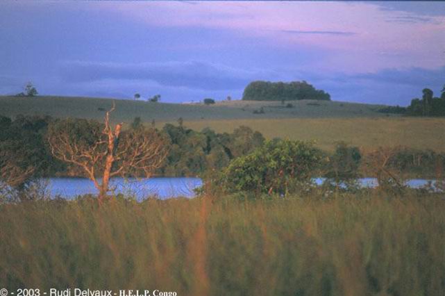
- the hydrographic network of the park is very
developed. It includes many lake systems (lakes Tchibinda, Tchivoka...), rivers
(Ngongo and its affluents: Mouissa, Louvandzi, Noumbi) and the lagoon of
Conkouati, the largest of the Republic of Congo, with 2400 hectares.
ø Historical and current context 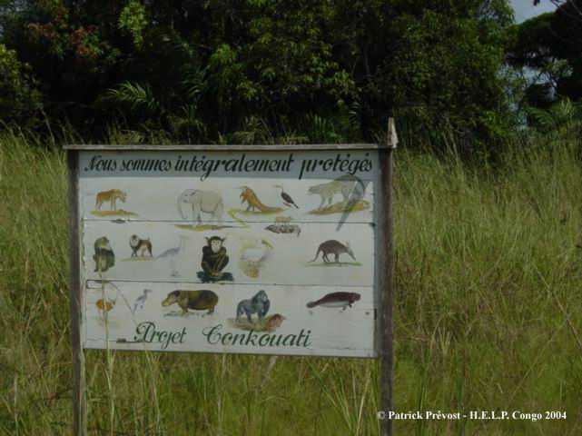
- The park, created in
1999, includes the old Reserve of Conkouati, created in 1980. Covering
nearly 300 000 hectares to its creation, this reserve saw its surface brought
back to 144 294 hectares by a legal provision of 1989. It was managed from 1994 to
1999 by the UICN within the framework of the PROGECAP-GEF Congo (Project of
management and conservation of the protected surfaces, financed until June 1999
by the World Bank) and was the subject of an agreement of Donation signed by the
Congolese authorities with the World Bank. Currently, the park is managed by a
team of the Ministry for National Forestry Commission in partnership with the
WCS (Wildlife Conservation Society), American NGO.
- the National park
of Conkoauti-Douli counts a marinates reserve all along the
littoral.
- For the terrestrial part of this park, it was defined the first
zoning for its management (maps - source WCS). The zone of integral protection
"Ngongo" corresponds to the heart of the old Reserve of Conkouati.
- In
September 1999, the patrols anti-poaching were suspended with the stop of
PROGECAP- GEF Congo. An increase in the pressure of hunting was followed from
there on the zone of Conkouati. We noted the presence of professional hunters
coming from Congo-Khinshasa. The engagement of the WCS since 2000 near the
Congolese authorities in the management of the Park of Conkouati-Douli allowed
the resumption of a true conservation and control program on this site. This was
accompanied, in particular since 2002, by an increase in the fight against
deforestation and poaching.
ø faunal and floristic Diversity
-
This park is of
great importance for the conservation of the bio-diversity. Thus, the zone corresponding to
the old reserve of Conkouati and its immediate periphery, whose Triangle, constitute a whole still relatively preserved
forests, primarily of dense type wet, and varied aquatic environments. Its
rich bio-diversity had led the Reserve of Conkouati to be classified by the UICN
among the critical zones to preserve for the protection of the African dense
forests. In the same way, this zone was included in the priority zones for the
conservation of identified by Birdlife International (zone s043; 1996) and it is
contiguous to classified areas of Gabon sites RAMSAR.
- the Park of
Conkouati-Douli counts very diversified environments:
· Open
savannas in direct edge of the forest;
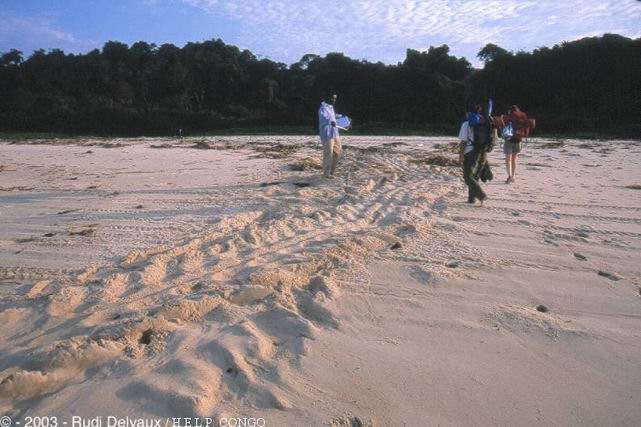 · An
important wetland, with its marine reserve, its coastal cord constituting
one of the most important world sites for the laying of the marine torttles,
several lagoons of which that of Conkouati, where lives a population of manatees
and finally an important network of lakes, rivers and marshes, supplied with a
levelling ground water and from important floods in rain season; · An
important wetland, with its marine reserve, its coastal cord constituting
one of the most important world sites for the laying of the marine torttles,
several lagoons of which that of Conkouati, where lives a population of manatees
and finally an important network of lakes, rivers and marshes, supplied with a
levelling ground water and from important floods in rain season;
·
A very varied forest (principal environments on the zone of the lagoon of
Conkouati): the latter forms part of the large forest block of
Mayombe, covering 3 % of Congo, one of the forest belts is the richest of planet on this
level. On the contrary remainder of the south of the Republic of Congo, this
site is still relatively intact. Moreover, this forest belt is single from its
inter-connection narrow with the aquatic environments present. Various forest
types are present: wet dense forests, marshy forests, coasted forests ,
subjected to the spray, mangrove or forests of average altitude.
- the
faunal diversity of the park is important for its diversity and its
importance in term of threatened species. Thus, of many taxonomists groups are
represented of which certain still badly known like the insects or the
batrachians. Others are represented by threatened species, some registered with
appendix I of the CITES like the chimpanzee, the gorilla, the mandrill, the leopard,
the forest elephant, or the crocodile with broad face.
- the threats
which weigh on the ecosystems of this park are important. These very varied
and complex natural environments are threatened on various levels by:
· Human activities like deforestation for activities of
subsistence or the commercial forestry development, the incendits, over fishing and
the poaching more and more with commercial goals (sale in Pointe Noire);
· The pollution of the aquatic environments related to the
activities of oil extraction at sea;
· The stranding of the lagoon,
partly related to the erosion of the grounds caused by deforestation
·
Total changes: the climatic changes could deeply modify these
environments, while exploiting in particular pluviometry. This area is
characterized indeed, by one dry season relatively long (5
months). The maintenance of forest cover is mainly related to
particular climatic conditions which, in dry season, ensure a
sufficient water content.
ø human Populations
- the population within the park counts
approximately 3000 people divided into villages gathering of 10 to a few
hundreds of people. It concentrates especially on long tracks and around the Lagoon
of Conkoauti. In addition, a certain number of campings of fishermen are
installed around the lagoon of Conkouati and the contiguous lakes. In the same
way, a sparsity of the population is located in forest in the campings of
fisherman-hunters. The zone of the Park corresponding to the old reserve counts
a density of population low, to the order of an inhabitant by km².
- the ethnics
groups present are Vili, populates savanna, fishermen of the lakes and sea
and Loumbou, much fewer, plus forest workers and hunters.
- Way of life and
elements sociocultural: the possession of the ground is collective and to hold a
ground personally, it is necessary to ask and buy the authorization of the chief
of the ground. Previously to cut down an animal, it was necessary to acquire the
downstream of the chief of the village, old person who has any authority in the
decision-makings for the village. Today, the hunters are "foreigners" and nobody
any more respects the ancestral rules. 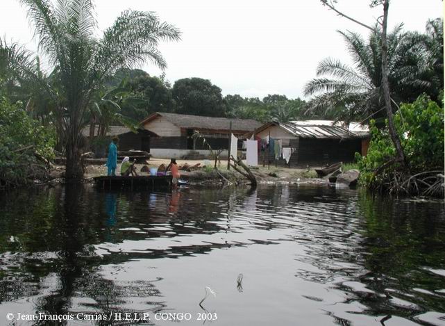
Each village has a totem, a protective animal which is forbidden
to consume. Other food taboos exist like that, for Vili, not to eat a chimpanzee
or, for the women, that not to eat reptiles. The bases of these taboos were lost
with time but continue to persist at the village. On the other hand, young
people who leave to Pointe Noire forget them well quickly.
- the
villages are organized in the linear space of way,
along the track. Each family (in the large sense of the family clan)
has a rectangular piece on which are built the box of the head of
household, the boxes "housing" of the women, the children, the boxes
"cooks", and in central position a hood which shelters the fire around
which they meet during the evenings. The box are built in burst boards:
very little is into hard. The roofs consist of sheets of palm trees
raffias. The pieces have a garden of box made up of fruit trees and a
palm plantation.
- hunting is an important activity, it is practised in a
traditional way with traps with collets or rifle, without animal
distinction: the hunted animals are the gazelles. Traditional hunting
is open all the year. Hunting for rifle is on the other hand strongly
controled by the Congolese legislation.
|