|
Home > Habitat > the Republic of
Congo
•The Republic of
Congo
Geography
 ø
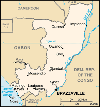
Located in central Africa, on the West
coast of the continent, the Republic of Congo (Congo-Brazzaville or Congolese
Republic) has a surface of 341 821 km² and stretches on 1200 km
on both sides of the equator. Its capital, Brazzaville, is separated by the
river Congo de Kinshasa, capital of the Democratic Republic of Congo (ex Zaire). ø
Located in central Africa, on the West
coast of the continent, the Republic of Congo (Congo-Brazzaville or Congolese
Republic) has a surface of 341 821 km² and stretches on 1200 km
on both sides of the equator. Its capital, Brazzaville, is separated by the
river Congo de Kinshasa, capital of the Democratic Republic of Congo (ex Zaire).
This country has common borders with: in north, the Central African Republic,
in the east and the south, the Democratic Republic of Congo, in south-west,
Angola (Cabinda enclave), in the west, Gabon and in the North-West Cameroun
(maps). Its particular form can evoke "a mom, sitting, looking towards the ocean
and nursing its baby". This country is located at 7 000 km in the south of France,
in the same time zone.
ø
Bordered in the west by the Atlantic Ocean,
the Republic of Congo has 169 km of coasts.
Parallels with those, are plains of around fifty kilometers wide,
dominated by savanna.
While going towards the center of the country, a mountainous zone parallel
at the coast is, Mayombe. This solid mass cuts the Republic of Congo,
while going from Gabon in the North-West with the Democratic Republic of Congo
and the Cabinda enclave in south-east. With the very broken relief, this mountainous
solid mass relatively low is almost entirely covered with forests.
After this solid mass the valley of Niari, river affluent the Kouilou
river. This valley opens in north on the mounts of Chaillu, solid mass which
extends in Gabon. We find here the climax of the Republic of Congo, with the
Mount Berongou (903 m).
Then extends the Pool, area of hills, deforested by the action of man
and which faces towards north with a succession of covered plateau of savanna.
The latter, the Téké Plateau or Batéké, are
separated the deep valleys where various affluents of the Congo river run.
Follows the Basin, zone semi-watery where the rivers form a grid through a dense
forest almost always flooded.
The extrem north of the country, towards the borders with Cameroun and the Central
Africa Republic is a crossed forest belt of many rivers.
ø the hydrous network of this country is very
important, with very numerous rivers, but also with lakes and
lagoons. The principal river is the Congo river, 4000 km length and second
larger flow in the world. It forms with one of its affluents, Oubangui, a part
of the border with the Democratic Republic of Congo.
ø
the
zones of equatorial
forests cover
more than a half of the surface of the Republic of Congo, being divided
primarily into three large blocks: the area of Kouilou with the forests of Mayombe,
the areas of Niari and Lékoumou with the forests of the mounts of Chaillu
and finally the forests of the Congo basin, in the north of the country. The
country has on its territory 10 % of the African forests.
Climate
ø the
climate, of a tropical type, is characterized by two great seasons: 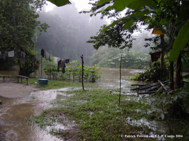
· The rain season, from October to April, very
frequent rain and high temperature (of 25°C with 35°C), stopped from January to
February by one period of weak rains, period known as "small dry season".
· The dry season, from May to September, characterized
by very few rains, moderate temperatures (between 18-20°C and 25°C) and an
important and low cloudy cover, suitable to the formation of fogs, important in
forest and that the Congolese often calls "snow".
ø the average
temperature in Brazzaville and Pointe Noire is of 25°C. The
average annual level of precipitations is 1 200 mm, even if important variations
are observed from one year to another. Average moisture is about 88 %. Lastly,
the average annual sunning is 1 519 hours (1 400 - 2 000) at Pointe Noire, with a
maximum in March (6,1 h/j) and a minimum in September (2,4 h/j).
Administrative
organization
ø the country is divided into a
commune, Brazzaville, and nine areas, each one having a place chief and
districts: coast towards the interior, Kouilou, Niari, Bouenza, Lékoumou, the
Pool, the Plates, the Basin (sometimes divided into Basin and Basin-West),
Sangha and Likouala.
ø Republican
system; National festival the 15 of august;
President in 2006: General Denis Sassou-Nguesso.
ø the
official and administrative language
is French.
ø Currency: CFA franc (1 euro being worth approximately 655,96 CFA).
Population
ø the
Republic of Congo counts 3 900 000 people in 2004,
the congolese. In 2003, life expectancy at birth was 51, 7 years
old and the birth rate of 6,3 children by women. AIDS touches a
great number of people, with in particular 4,9 % of the 15-49 years are
reached (fidurs quantified, www.worlbank.com). More than half of the
population lives downtown, primarily in Pointe Noire and
Brazzaville. The latter saw doubling its population between 1980 and
1990. Lastly, let us note that this country is a land of welcome,
especially following the conflicts in the area of the large lakes, with
approximately 91 000 refugees in the 1° January 2004.
ø the
majority ethnic group
is the one of the
Kongos (especially localised in the area of Brazzaville; but various
ethnic groups are connected to them, like the vilis, living on the
coast) then we find the Sanghas, the Batékés, and the
M'bochis. This country still counts some populations of pigmés
(Bakas).
ø half of the
population is Christian (catholics and Protestants), the other half practice the African traditional religions and 2 % of the Congolese are
Moslem.
ø Among
the principal languages spoken apart from the French, we can quote the lingala (50 % of the
population), the monokutuba, the kikongo and the lari.
Communications
ø Ways of
transportation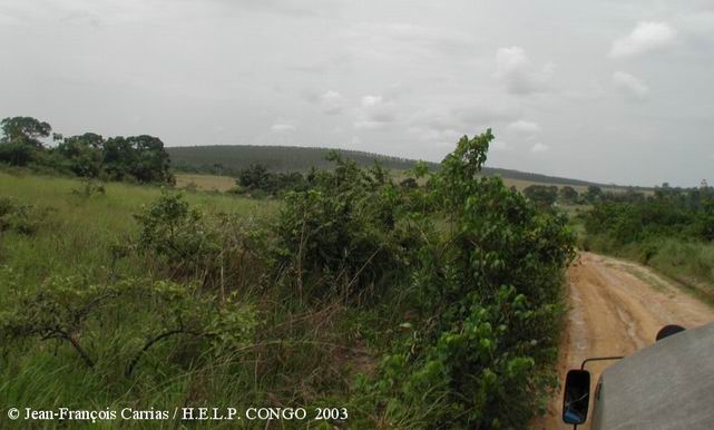
- Roads: they are in general difficult ; in 1996 we could count
12 800 km of roads, including only 1242 km of tarred roads.
-
Railways: 894 km in 2000; the principal line, often stopped during the interior
conflicts, binds Brazzaville to Pointe Noire, the economic capital and only true harbor of the country;
- Ways navigales: the rivers are the
principal transportation roads; 1120 km are navigable.
-
Airports: about thirty are distributed in the country but only 4 had tracks
tarred in 2000; two more important, where arrive in particular the main part of
the international flights are those of Brazzaville and Pointe Noire.
ø Information flow
- television remains not very widespread, with in 1999 less than 40 receivers for 1000
inhabitants. The electrical supply network is very little developed, existing
especially in the principal cities and prone to many cuts.
- the
"traditional" telephone, is also not very developed with less than 11 lines for
100 inhabitants in 1997. The development of the portable telephone is on the
other hand into full expansion, especially since the beginning of the years
2000.
- the access to Internet develops also more and more since
the beginning of the years 2000.
History
ø the
Pygmies seem to have been the
first inhabitants of the area. Populations of Bantoue language, using with skill the
work of iron and agriculture, appeared during the 1° thousand-year before
our era. Several bantoues kingdoms, in particular the Kongo kingdom, built a
network of exchanges on the scale of the basin of the river Congo (the name of
this river comes from the name of the Kongos people).
ø the
first contacts with Europeans took place in the XV° century and trade developed with the local
kingdoms. In the XVI° century, Portuguese baptized Punta Negra the
future site of the town of Pointe Noire.
The coasted area was a major place for the draft of slaves. The stop in
the XIX° century of this draft brought the decline of the
bantoues kingdoms and allowed the development of colonialism.
ø the
European penetration really
began in 1875 with Pierre Savorgnan de Brazza, French explorer of Italian
extraction and creater of the town of Brazzaville. The colony of French Congo
was founded in 1891 and some concessionary companies divided the territory. At
the time of the creation of the French Equatorial Africa, in 1910, with
like capital Brazzaville, the territories explored by Mr. de Brazza were divided
into two countries, in the west Gabon and in the east Congo.
ø In 1911,
the concessionary companies, guilty companies of exactions towards the local
populations, was in great part desseased from their territories. But the anticolonialism reaction was initiated especially between the two world wars. Father
Fulbert Youlou benefitted from this context in 1955 to supplant the local
political chiefs and to reach in 1958 the place of prime minister. He brought the
country to total independence in 1960.
ø Fulbert
Youlou was reversed in 1963 by a popular revolution
(the Three glorious ones) and replaced by Massemba-Debate. This one was in its
turn relieved in 1968 by the army. A period of instability settled then which
saw the accension of the captain Gouabi.
This last gave to the country its
title of popular Republic of Congo, name of the country of 1969 to 1992.
Assassinated in 1977, Gouabi was not replaced by the General Yhombi-Opango,
relieved in his turn in 1979 by its second, colonel Sassou Guessou. First of all
pro-Soviet and Marxist-Leninist, the regim evolved in years 1980 to a
pragmatic liberalism. But only one party remained to power : the
Congolese Labour Party or PTC.
ø In
1990, under the pressure of the trade unions and the
churches, the government authorized the multi-party system. In November
1992, a civil, Pascal Lissouba reached the presidency (prime minister, André
Milongo). As soon as elected, P.Lissouba decided to apply the theory of the
tribe-class which it had developed in its youth when he was an ideologist of
Congolese socialism. For him the "class struggle" conceived by Karl Marx could
not applied in Africa. It was imperatively to be adapted to the traditional
social structures: the tribe replaced the class.
ø In less
than three months, the political climate was degraded. It resulted
from it a political agitation and social which resulted in strikes and
demonstrations from the streets. The conflicts burst in November 1992 in
Brazzaville between the militia of P.Lissouba and B.Kolélas, mayor of
Brazzaville. The victory with the legislative elections of 1993 of the coalition
to the power was strongly disputed by the opposition. The militia of the
latter opposed violently the pro-governmental militia and the army. This
first civil war will end only on January 30, 1994, when P.Lissouba
carried out a spectacular reversal and was combined temporarily with its
adversary. It caused the death from 3 to 4000 people.
ø the
conflict of 1997 - the country was
impoverished between 1992 and 1997, mortgaging its resources by a policy of
loans guaranteed on the future oil receipts. In 1997, the presidential elections
were engaged, adverse the president in place and the General Sassou-Nguesso,
former president. It is at the beginning of June that the engagements
between the two parties burst. France took part by imposing a
mediator: Gabonese president Omar Bongo. This one imposed with difficulty a
truce and talks. September 15 proceeded the "top of Libreville" in Gabon,
bringing together the presidents of the close countries and the opponents
Congolese. They ruled on the need for an international mediation to
restore a democratic capacity. In the days which followed, P.Lissouba lost the
control of Brazzaville. He left the Palace of the People with his entourage. The
Sassou-Nguesso General took then the head of the country. He was proclaimed
president in October 25, 1997.
ø political
climate between the end of 1998 and the beginning of 1999 - the
tensions were orchestrated by the former militians of the various camps
(Ninjas, at the origin pro-Kolélas, mayor of Brazzaville, Cocoyes, pro-Lissouba
and Cobras, pro-Sassou Nguesso), become plunderers. The things accelerate
with the resurgence of the Ninjas and the crisis of the Pool, at the end of the
summer 1998. October 24, will take place a dialogue of the World Council of
Christian Churches on the crisis of the Pool and establishment a committee of
mediation. However in November 14, 6 members of this committee were killed in
Mindouli and the crisis worsened with the beginning of the implication of
Cocoyes. The beginning of December saw the intervention in the Pool of
Angolan units of the army. The fixings were done increasingly many in the south
of Brazzaville. Since September 1998, 30 000 people would have fled the Pool, 20
000 in direction of Brazzaville and Black Pointe, 10 000 in Democratic Republic
of Congo. Thousands would have taken refuge in forest. December 18, the Ninjas
entered the southern districts of Brazzaville. Then began the blockade and the
"cleaning" of these districts. The districts of Bacongo and Makelekele were
reopened only in May 1999. This period was characterized by massacres,
plunderings and knowing the exact truth remains difficult, to
establish the responsibilities even more. But the number of refugees
amounts of ten thousands. Spring and summer 1999 transfer the
resumption of discussions. Congo-Brazzaville, since the end of 1999
and the agreements signed under the good auspices of Gabon,
seems to know a return to a certain political stability.
ø 2002:
Re-election of Sassou Nguesso to the
presidency - Drafting of a new constitution, reinforcing his power.
Current economic
situation
ø Agriculture 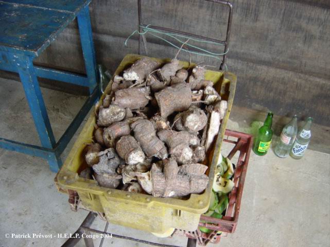
The self-subsistence is the rule in
rural environment (40 % of the population). Agriculture rests between the hands of
the women who use the traditional techniques ofecobuage, of burn-beating etc.
The
manioc is the basic food, cultivated with secondary plants such as sweet potato, the
taros, pea, groundnut or corn. The commercial cultures are based on the
production of coffee, rice and of tobacco on the plateau like the cocoa
located in the area of the "Basin".
Some productions of fruit and vegetables
are in the south. Savannas of the south nourish the ovine and porcine herds and
breeding. The rest of the country practises a traditional small animal
breeding.
Hunting in forest and fishing at sea and lakes are auxiliary
activities (certain ethnic groups, as it is the case in the area of Conkouati,
depend on it to 80 %). They are practised by the men.
ø Industry - Various Economic
Situation
From the economic
point of view, the foreign debt is three times today higher than Gross
domestic product (GDP). In 1995, with a GDP of 680 $ (world average, 4 880 $),
the Republic of Congo came just behind Gabon (3 490 $) and in front of these
other frontier countries. But its foreign debt is one of the most important of
central Africa with 12 243 million dollars in 1995 (against 5 512 for the DRC or
900 for Cameroun). Moreover, the foreign investment is very weak (1 million
dollars for the direct investment in 1993-95 against 71 in Cameroun) and the
assistance with the development represents nothing per person but
4 $ in 1995 (against
34 in Cameroun, 48 in DRC or 133 in Gabon). The country is far
from self-sufficiency food and the problems of provisioning impose
high prices. The cost of living is consequently with the second rank in
Africa after Gabon. The situation of this country is thus still
precarious in 2005.
First resource of
the country: the oil, exploited primarily starting from the stations
offshore oil rig with broad of Pointe Noire. The first layer was discovered in
1960. In 1999, the oil sector contributed for 47,5 % of the GDP at constant
prices, ensured 91,2 % of the export earnings and 60,2 % of the budget of the
State. The Republic of Congo is the fourth sub-Saharan producer country.
 Second
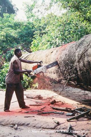
resource by its importance, wood. The old French administration set up
the forestry development at ends of export. The forestry developments are
located mainly along the Niari river, in the south. In 1999, forestry
development represents 9 % of the GDP. Second
resource by its importance, wood. The old French administration set up
the forestry development at ends of export. The forestry developments are
located mainly along the Niari river, in the south. In 1999, forestry
development represents 9 % of the GDP.
At the mining level, geological
knowledge remains still badly established. The country however seems equipped
with diversified mineral resources. Gold is present in the solid mass of
Chaillu and Ivindo, in the chain of Mayombe and the basin of Sembé-Ouesso. It is
exploited in an artisanal way by the gold washers. To diversify the bases of the
economy, the government intends to develop the mining sector.
Congolese manufacturing industry is little developed
and covers mainly the fields of the textile, agro-alimentary and the brewery.
The industrial activities gather in the south of the areas of the Pool, Bouenza
and Kouilou. It would represent hardly 8 % of the GDP. This sector was dominated
a long time by the public companies, characterized by the important ones and
massive losses, a heavy debt, a very bad management and plethoric manpower. The
sector suffers in addition, of the narrowness of the domestic market, the high
cost of the factors of production, of a labour little qualified and problems of
transport. It undergoes the competition of the abstract sector more and more.
The market of drinks constitutes the 2/3 of the total sales turnover of
manufacturing industry.
Ecological
situation
ø Congolese forests
We estimate at twenty
million hectares the surface of the Congolese forests, of which 80 % are
considered commercially productive. They have a great biological diversity with
more than three hundred species. They are distributed between three principal solid
masses, different the ones from the others from the point of view of
their extent, their floristic composition and their development:
- solid mass of Kouilou-Mayombe, a surface of 1, 4 million hectares
approximately, the least wide solid mass; its exploitation started timidly at
the beginning of the years 1930 and was accentuated after the Second World War.
Today, it knows an exhaustion due to the overexploitation supported by the
proximity of the Wearing of Pointe Noire. It currently contributes to the
national production with height of a little more than 70.000 m3 grumes/an, that
is to say 11 %. L Okoumé (Aucoumea klaineana) and Limba (Terminalia
superba) are the principal species.
- solid mass of
Chaillu - Niari, second solid mass with a surface from approximately 3, 5
million hectares; its exploitation started in the years 1960 with the startup of
the railway Comilog. Okoumé is the principal specie (70 % of volume on foot),
followed of Limba. The solid mass knows also a certain exhaustion and takes part
in the national production with 150.000 m3 height grumes/an, that is to say 21 %
approximately.
- solid mass of North - the Congo, most
important in term of surface (15 million easily flooded hectares
approximately including 7 million) and of the potentialities. Two principal species are exploited: Sipo (Entandrophragma useful) and the sapelli
(Entandrophragma cylindricum). This solid mass takes part in the national
production with 480.000 m3 height grumes/an, that is to say 68 % approximately.
The Congolese forest potential is still badly known, since hardly five
million hectares (approximately 25 % of the forest surface of the country) were
inventoried, at some very low rates of survey (0,2- 2,5 %), on the basis of
cartography often not very recent. Nevertheless, the potential of exploitation
of these forests sharpen many appetites. Thus, the possibilities of annual
production are estimated around two million m3 barks.
To this natural
potential, are added 73.000 hectares of forest plantations, made up mainly of
eucalyptus (60.000 hectares), limba (7.500 hectares), pines (4.500 hectares) and
other species (1.000 hectares).
Forest products others than wood,
in other words produced secondary or not woody are numerous and play an
important part in the Congolese economy: wild vegetables, fruits, lianas, canes,
caterpillars, etc. The consumption of these products touches the fields food,
medical or cultural. Various studies made it possible to identify 166 species
of food plants belonging to 55 families, 800 species of medicinal plants
belonging to 1000 families and several other species used for the various
needs (construction, basket making, culture etc).
Statistical data consulted in a document going back to 2001 on www.fao.org
ø protected surfaces and their
management
The Republic of
Congo counts approximately 36 500 km² surfaces protected (from nearly 17
000 km² in 1977), that is to say overall 11,6 % of the territory. This figure
includes in particular:
1°) of the zones protected at the
international level:
· a site RAMSAR (International Convention
for the protection of the wetland), the Tele-Likouala lake with Grasses in the
North-East, in the area of Likouala;
· a Reserve of Biosphere,
the reserve of Dimonika, in the north of Pointe Noire.
2°)
of the zones protected by the national
legislation:
· Reserves of Fauna or hunting of which reserves
of Lékoli-Pandaka (50 000 ha, in the North-West), of Tsoulou (30 000 ha, in
south-west), of the Mount Fouari (16 000 ha, in the area of Niari),
of Léfini (630 000 ha, north of Brazzaville);
· Three
national parks : the National park of Odzala-Kokoua (Area of the Basin -
Created in 1935 - Extension in 2001 to 13 600 km²), the National park of
Nouabalé-Ndoki (Northern west - Created in 1993 - 4200 km² - Integrated with the
National park Lobéké into Cameroun and of Dzanga-Ndoki in RCA in a plan of
management tri-national), and of Conkouati-Douli (Kouilou - Created in 1999
starting from the Reserve of Conkouati -5050 km² )
But the protected zones
would be more and more important in the near future. Thus, in February 2004, the Republic of
Congo announced a plan of extention of these zones, far-sighted:
1°) the creation of the National park of Bambama-Likana, which
will constitute a transborder surface protected with the National park from the
Bateke plateau in Gabon;
2°) the widening of the marine reserves
located along the coast, by connecting the National park of Conkouati-Douli to
the National park of Mayumba, in Gabon, in order to protect the beaches, the
marshes and the coastal forests, which are of a world importance, in particular
some of these zones being one of the most important sites of reproduction for
the marine tortules.
3°) creation in the south of a transborder
surface protected along the borders from Angola and the Democratic Republic from
Congo.
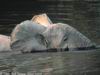
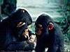
In this country, we counts also four important
sanctuaries for great monkeys: the sanctuary of the chimpanzees of
H.E.L.P. Congo,
the sanctuary of chimpanzees of Tchimpounga, the sanctuary of Gorillas of
Lésio-Louma and the sanctuary of gorillas of Lossi.
The environmental
protection is at the charge of the Ministry for the forest Economy and
the Environment. Many problems, lacks of financial means or competences in
particular, handicap the management of protected spaces. The World Bank, by the
means of the GEF (Total Environmental Fund), was implied financially
until 1999 through the PROGECAP (Project of Management and Conservation of the
Protected Surfaces). The socio-policies events of the end of the Nineties
brought at the time to the almost total stop of the environmental programs in
the country. The return to a more stable situation, the development of the
initiative "Forests of the Congo Basin", or the implication increased from
certain large ONGS as the WCS (Wordlife Society Conservation) make it
possible to see the comeback of the conservation of these zones protected like a
priority.
ø environmental Impacts of the human activities
1°) Deforestation - For one very recent time, the
forests in the Republic of Congo have been subjected to a phenomenon of increasing
deforestation. The principal causes are itinerant agriculture, the irrational
forestry development and the exploitation for the requirements out of wood for
heating. The evaluation of the forest resources carried out by FAO in 1990
indicates a rate of deforestation of about 0,10-0,15 %, that is to say 25-35.000
hectares per annum.
2°) fires of savanna - they are extremely
numerous, more still in rain season. With the origin, the hunters light them to
attract game in environment discovered thanks to the new grass growths. Currently
they concern only the tradition because the game disappeared. Fires impoverish
the ground considerably and thus maintain a close-cropped pseudo-steppe which
can be characterized of anthropoclimax, i.e. an environmet which balance is
maintained by the man.
3°) cultures on stubble-burnong - the principal
culture is the one of the manioc. It is practised in an itinerant way. The
general tendency is that to rather exploit the surfaces regained by the
secondary forests than to deforest the primary forest.
4°)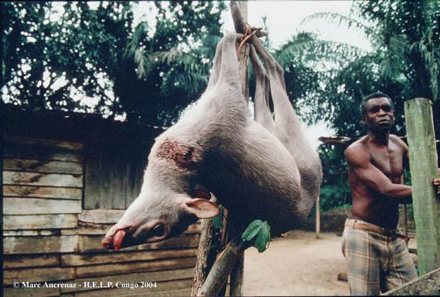 Poaching
- the consequences of the poaching are felt on the evolution of the
forests, in more of the threats which it makes weigh directly on many
animal species. Indeed, the large mammals suchas the gorillas
or the elephants, become rare, take part in the dispersion of seeds,
the elimination of a certain vegetation etc. Forest dynamics is
modified because of their rarefaction. Poaching
- the consequences of the poaching are felt on the evolution of the
forests, in more of the threats which it makes weigh directly on many
animal species. Indeed, the large mammals suchas the gorillas
or the elephants, become rare, take part in the dispersion of seeds,
the elimination of a certain vegetation etc. Forest dynamics is
modified because of their rarefaction.
But the activity of poaching becomes the
principal source of income for certain ethnic groups and especially the object
of an intensification, exceeding the framework of remaining. More and more the
bush meat becomes the object of a very lucrative traffic.
Indeed, the markets of Brazzaville and Pointe Noire offer a very important
outlet, the urban population increasing and consuming little meat of breeding
(very little developed in the Republic of Congo). We can speak sometimes about true
networks of poaching. The hunters are often final links, driving out for others,
the latter being owners of the weapons and ammunitions.
In addition, each
zone open to the forestry development is synonymous with roads and access
facilitated to the forest. Thus, the forestry development worsens the
poaching. Certain forest companies recruit even hunters to nourish in situ
their meat workers with bush food.
Maps
To
know some more
ø Some sites among others: http://www.republique-congo.com / www.congo-site.net / www.worldbank.org / fr.wikipedia.org/wiki/R%C3%A9publique_du_Congo / www.congo-brazzaville.ifrance.com
ø a book, important for better understanding the civil war 1998-1999: "Congo-Brazzaville - political
Drifts, humane catastrophe, desires of peace". Collection Rupture-Solidarity -
Nouvemme series N° 1 19999 - Karthala Editor, 22-24 Arago boulevard, 75013
Paris, France.
The Republic of Congo in figures:
The World Bank
|